

What the public record supports
Location, year, current site media and technical context are present in the company-managed record. Customer identity, contract tier, quantities, measured outcomes and acceptance documents are not public.
- Classification
- Application reference (internal record)
- Location / year
- Tianjin, China · 2025
- Entity / role
- Customer, contracting entity and contract tier are not public.
- Quantities / results
- Capacity, quantity, tonnage, schedule and measured results are not public.
- Record reviewed
- 2026-07-17
Disclosure limit: Use as an internal application reference and engineering-planning example. Request the authorized role and scope record before qualification use.
How East Baoyu classifies and verifies evidencePublic Record and Evidence Boundary
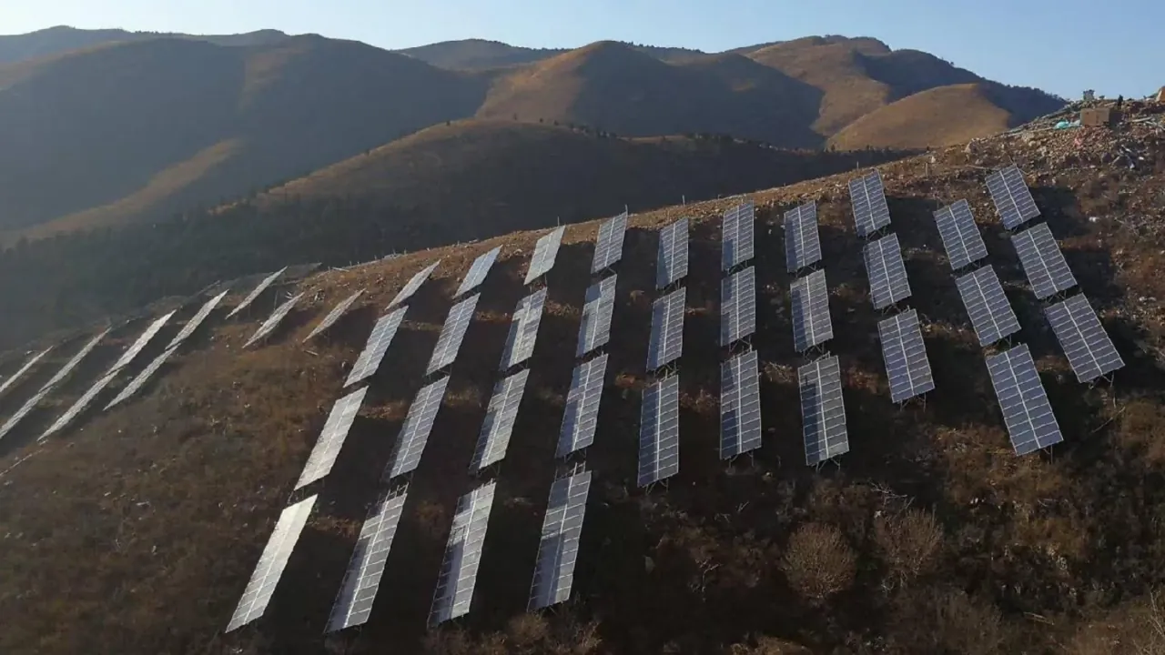
The company-managed record identifies a mountain PV application reference in Tianjin, China, dated 2025. The page publishes a title, location, year, image and technical context. Customer identity, contract tier, MW, quantities, measured installation results, approved calculations and acceptance documents are not public. This page therefore explains the engineering route without presenting those restricted facts as verified outcomes.
Why Mountain Sites Need a Different Data Set
Mountain terrain can change slope, row elevation, access, drainage and ground conditions over short distances. A single standard table and foundation schedule may create excessive field adjustment or conflict with grading limits. The design process should divide the site into terrain and loading zones using the current survey, geotechnical information and module layout.
Key inputs include cross- and along-slope geometry, wind exposure, snow drift where applicable, seismic criteria, runoff paths, construction access and vegetation or land-use constraints. The supported structure must tolerate the approved survey and installation variation while keeping module alignment, ground clearance and connection demand within the design limits.
Terrain-Adaptive Structural Decisions
Adjustability should be designed, not improvised. Post length, brace geometry, connection slots, rail splice position and foundation head detail need defined adjustment ranges and edge conditions. Large adjustment demand may increase eccentricity, unbraced length or connection forces. The drawing should identify the permitted range and the point at which an engineered exception is required.
Foundation choice may vary by zone. Screw piles can be appropriate where installation access, ground conditions and acceptance testing support them; other zones may need a different route. Installation equipment stability and safe working platforms are part of feasibility. Torque, penetration, alignment, final elevation and refusal records should be linked to location references that the site team can audit.
Fabrication, Identification and Logistics
A zoned bill of materials helps prevent similar-looking components from reaching the wrong row. Member, connection and hardware labels should map to drawing revisions and terrain blocks. Coating protection, touch-up rules and handling methods need to account for constrained access and multiple transfers from the delivery point to the installation face.
The documentation schedule can include material, dimensional and coating records, together with installation and test records generated on site. Hold or witness points should be agreed before production and before high-volume installation begins.
Public Outcome Statement
The public value of this reference is the terrain-adaptive planning route: survey zoning, controlled adjustability, foundation verification, component identification and access-aware delivery. No quantified claim for earthwork reduction, installation speed, energy yield or cost is published because the supporting baseline and measurement record are not public.
Information for a Comparable Review
- Topographic survey and terrain-zone model
- Module/table layout and structural reactions
- Geotechnical profile and installation-access assessment
- Wind, snow, seismic and drainage criteria
- Adjustment range, ground clearance and interface requirements
- Coating, test, identification, packing and delivery requirements
Provide the available site and design information for a zoned technical review. The resulting proposal should identify assumptions, missing inputs and the documents required before release.